
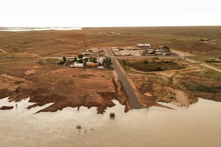
Just when it looked like the Birdsville Track might finally be settling down after a huge year of flooding, Cooper Creek has gone over the track again.
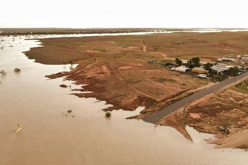
Floodwater from the Upper Cooper has spent more than two months making its way through the Channel Country. On August 13, aerial footage from Arid Air showed that water had once again reached the Birdsville Track crossing. Recent local rainfall has added to the problem, with another 21mm reportedly falling around the area.
For anyone planning a run up or down the Birdsville Track, the important message is simple: this isn’t currently a case of packing the recovery gear and having a crack. Large sections of the route are officially closed.
What’s closed right now?
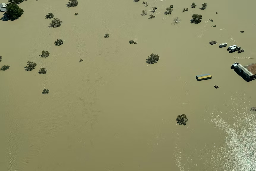
As of the South Australian Department for Infrastructure and Transport’s August 13 update, the situation along the Birdsville Track is messy.
The Cooper Creek causeway is closed to general traffic, although local 4X4 access is currently permitted with warnings about soft edges and soft road surfaces. The section from Cooper Creek south to Marree is also closed, with water across creek crossings and road surfaces considered too wet for traffic.
Further north, conditions aren’t much better. The section between Mungeranie and Cooper Creek has deep scours, washouts and wet surfaces, while the South Australian border to Mungeranie section is closed to the publicbecause of significant flooding around Clifton Hills Station and Mungeranie.
Authorities are telling travellers to make alternative plans for the foreseeable future. The famous Birdsville Inside Track is also closed because of flooding. In other words, you currently can’t simply drive around the Cooper Creek crossing and continue your trip.
What about the Cooper Creek barge?
Here’s where things get interesting. The huge Cooper Creek barge installed during the previous flooding remains at the crossing. Authorities deliberately left it there while monitoring floodwater moving down from Queensland. That decision is suddenly looking pretty sensible.
However, the Department for Infrastructure and Transport currently says the barge service is not in full operation, while access to the ferry crossing is affected by boggy and soft ground.
That distinction matters for 4X4ers. Don’t plan a Birdsville Track trip assuming you’ll simply arrive at Cooper Creek and catch the barge across.
The infrastructure might be there, but access roads, water levels and ground conditions all need to be suitable before it becomes a practical option.
How can water from months ago still be causing trouble?
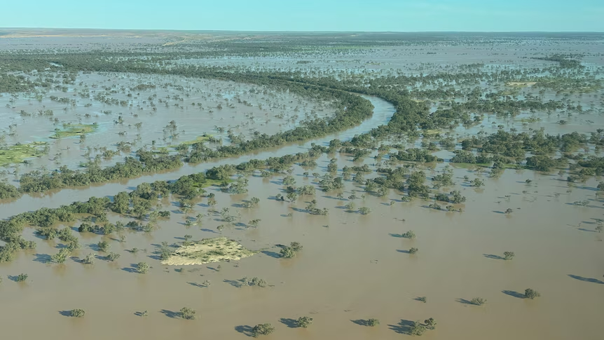
This is the fascinating part of the Cooper Creek system. Unlike a small creek that rises after a storm and drops a day later, Cooper drains an enormous chunk of Queensland’s Channel Country. Floodwater spreads across plains, waterholes and countless channels before slowly working its way southwest. The water now reaching the Birdsville Track started its journey more than two months ago.
That’s why the area can look completely different from the weather forecast above your campsite. It might not have rained heavily where you’re standing, but thousands of megalitres of water can still be arriving from rainfall that fell hundreds of kilometres away. Eventually, much of that water continues towards Kati Thanda–Lake Eyre.
Don’t treat a closed road as a 4X4 challenge
This is probably the biggest point for anyone travelling through the region. A road closure isn’t a suggestion that conditions are difficult. It means the road is closed.
Driving wet outback roads can cause enormous damage. One vehicle pushing through saturated clay can leave wheel ruts that remain long after the floodwater disappears. It can also turn a straightforward recovery into a serious remote-area problem.
There’s an added catch this year. Flooding hasn’t simply put water across the track. Some sections have suffered scouring and washouts underneath the surface. A section that looks passable from the driver’s seat may have soft edges, deep erosion or damaged creek crossings waiting underneath it.
What should Birdsville Track travellers do?
If the Birdsville Track is part of your plans over the next few weeks, flexibility is going to be essential. Don’t rely on road conditions you checked before leaving home. South Australia’s outback road report is updated whenever conditions change, and several Birdsville Track sections are being reassessed as surfaces dry and floodwater moves through.
Conditions can change rapidly in both directions. A road can reopen after several dry days, then close again after local rain or another flood pulse arrives. For now, travellers heading towards Birdsville from South Australia should assume the traditional Birdsville Track route is unavailable unless the official road report says otherwise. And strangely enough, that’s part of what makes this flood event remarkable.
Australia’s most famous outback track is being cut by water that began falling months ago and hundreds of kilometres away. Cooper Creek is doing exactly what Cooper Creek has always done.
This time, however, there’s a very expensive barge sitting beside it waiting to see what happens next.


