
Pat heads up to WA’s iconic Kimberley region and discovers there’s more to it than the Gibb River Road. Read on to find out.
The Kimberley township of Kununurra can get quite warm. Just ask our cameraman Bernie Kavanagh, who, at 9 am in October, was ferried off to hospital in an ambulance with heatstroke. Yes, you read that right, at nine o’clock in the morning. It was 42 degrees Celcius and Bernie was lugging a big video camera and bigger sticks (code for tripod) in the sweltering heat. I’m sure it had little to do with the eleventeen poolside ales he had consumed the day before…
You wouldn’t typically plan to be travelling around the Kimberley in October during the build-up to the wet season, but Covid restrictions had pushed our run late. Was it worth it? Well, you tell me after dialling your focus into these Tommy Salmon images within.
Your regular Kimberley 4X4 journey starts at Kununurra and finishes at Broome, running north to Mitchell Falls. But this time around would be different. Producer Paul Waterhouse had sniffed out promising-sounding locations that would keep us within a 100-mile radius of Kununurra. It was a gamble, but one that paid off handsomely.
OLD KURUNJIE TRACK
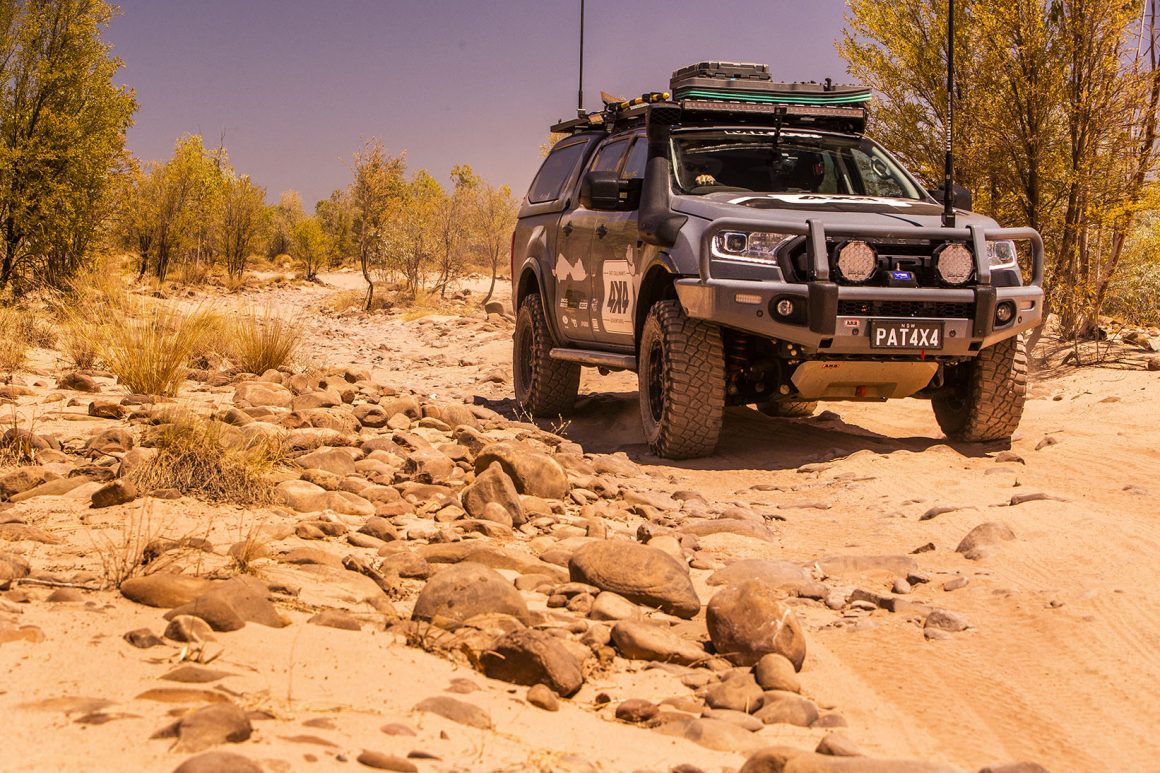
The most photographed part of the Kimberley, is undoubtedly the Pentecost River crossing, with the backdrop of the Cockburn (pron Coburn!) Ranges. It’s a beauty and looks incredible at most times of the day. A myriad of tracks flank the eastern side of the river, and if you head north, you will discover one of the finest tracks in the region. The Kurunjie Track also called the ‘Old Kurunjie Track’, and the ‘Cockburn Circuit’ tracks the Pentecost River to the north before jutting northeast towards the town of Wyndham. The scenery on this 70-odd kilometre journey punches you in the face and says, “I am the Kimberley!” You’ve got the croc-infested Pentecost River for starters. And then there’s the Cockburn Ranges. On the Gibb River Road, you drive past them in a mere 10 or 15 minutes. On the Kurunjie, you stare at them all day, creating an incredible backdrop. Then there are the rocky sections and Boabs – more A-Grade Kimberley. But indeed, one of the most photogenic parts of the Kurunjie Track is the cracked earth claypans that run for kilometres. Around them lies a savannah grassland that makes you expect an antelope to jump out of the bush.
As much of the track follows the El Questro leasehold, there is limited camping on the rack itself. If you want to camp, I’d recommend starting your journey from the northern end and camping on the Pentecost River. There are a few gates on the journey and a few ominous-sounding signs. But if you read them in detail, you’ll discover that the track is open; they just implore you to look after the gates and the track.
Allow a full day to drive the Kurunjie Track, and my recommendation is to experience either a sunrise or a sunset on the track, as the colours of the Kimberley at those times are simply magical.
FIVE RIVERS LOOKOUT

The Kurunjie Track terminates near Wyndham, a wonderful town with about 800 humans on site. While driving around here and seeing the industry, history, waterways and lookouts, I questioned why this place was not a tourist mecca. Property here would make a great investment I remarked.
But then, while it’s a spectacular setting on the eastern edge of the Cambridge Gulf, it does have one downfall. It’s, well, bloody hot. The average temperatures here are hotter than anywhere else in Australia. What does that mean? Well, while places like Marble Bar are judged as the ‘hottest’ towns in Australia for their daily maximum temperatures, Wyndham is judged on its average temperature. So yes, it gets hot in the daytime, but it tends to stay pretty damn hot at night too. We experienced nightly temps at the local caravan park of a balmy 36 degrees at 10 pm.
Soaring above the port town is the magnificent Five Rivers Lookout. You take a winding bitumen road to the top of the range, roughly 10 minutes from the centre of town. You’re afforded some of the best land-based views in Australia from up here. The rivers in plain sight include the Durack, Pentecost, King, Ord and Forrest.
PARRY LAGOONS (Marlgu)
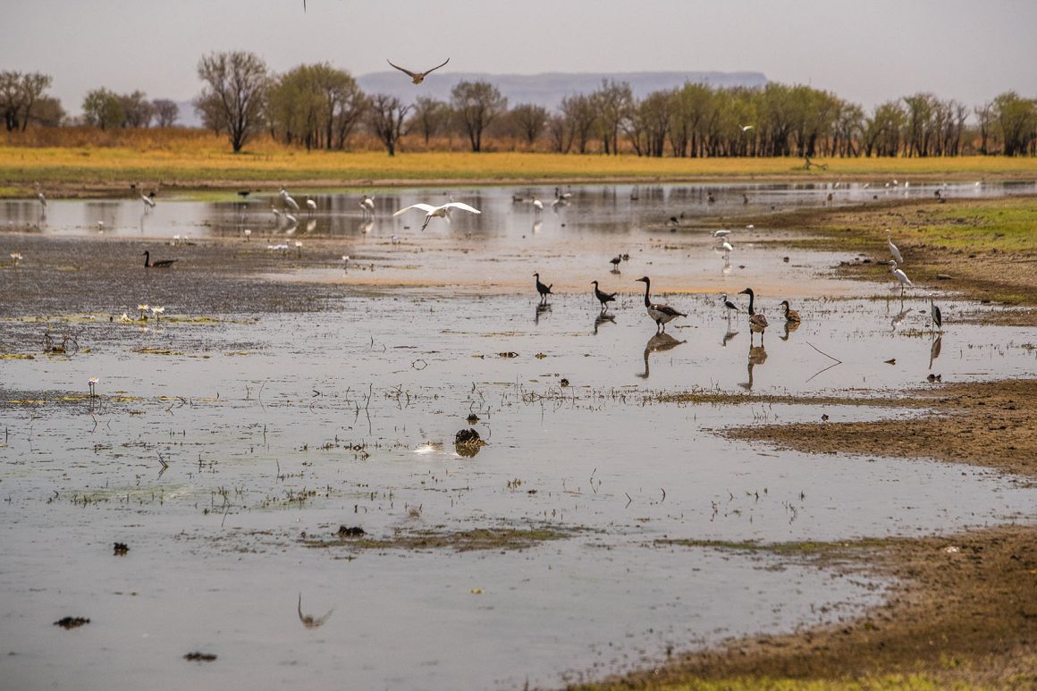
If you like your birds on the big side, Northern Australia is where it’s at, and Parry Lagoon would surely be one of the finest observatories. The road is picturesque, particularly when you start winding your way down to the lagoon. There are the remains of an Old Telegraph Station, and Yellow Kapok trees punctuate the beauty of the journey.
While many lagoons evaporate in the dry season, Parry Lagoon stays wet year-round. As a result, the concentration of the birdlife is superb. Expect to see egrets, spoonbills, ibises, herons, many species of waterfowl, magpie geese and stilts. Best of all, they’re relatively easy to spot with the well-constructed and shaded bird hides that sit over the water’s edge.
SECRET SPRINGS
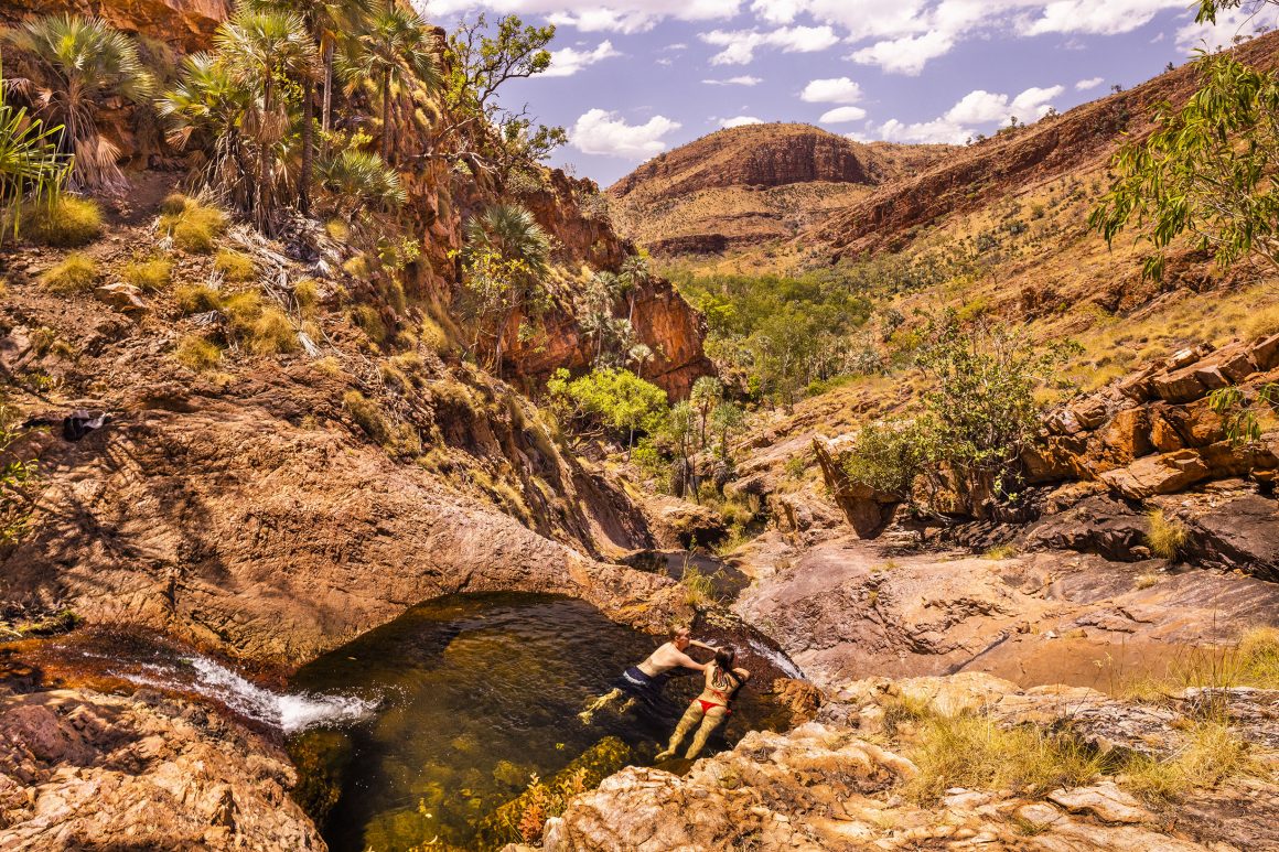
From Parry Lagoon, we head towards Kununurra, and you’ll see a turnoff to Spring Creek. The simple sign gives no hint about the journey on which you’re about to embark. This is a proper 4X4 track, with around five river crossings, rocks, mud and even wheels up in places. And it’s spectacular. The track winds along the valley floor and gorgeous ragged red hills flank you on either side. Cabbage tree palms, cycads and pandanus thrive in the moist valley, and the river crossings are awesome. May are long bendy affairs, where you can’t see the exit. However, at least in the dry season, they’re not too deep, and with a rocky base, you’re not in danger of getting bogged.
You’ll discover a small car park and a beautiful pool with a waterfall on arrival. This bottom pool is where most people stay, lolling around in the croc free waters. However, if you’re more adventurous, the rewards are superb. Clamber up the rocks to your right, and you’ll find pool after pool. One makes for a cracking rock jump (too scary for me though!). While up near the top you’ll find a sun-drenched infinity pool with endless views down the valley. The water in the crystal clear pool is warm and wonderful, but the views are to die for. This was an absolute highlight of our journey.
A few notes on this place, though. The walk (clamber) up the rocks, while not incredibly difficult, isn’t for everyone. You could suffer a long and bumpy fall if you get it wrong, which is highly possible with wet feet. So be careful, and I wouldn’t recommend the top waterholes with small children.
SECRET SPRINGS (2)
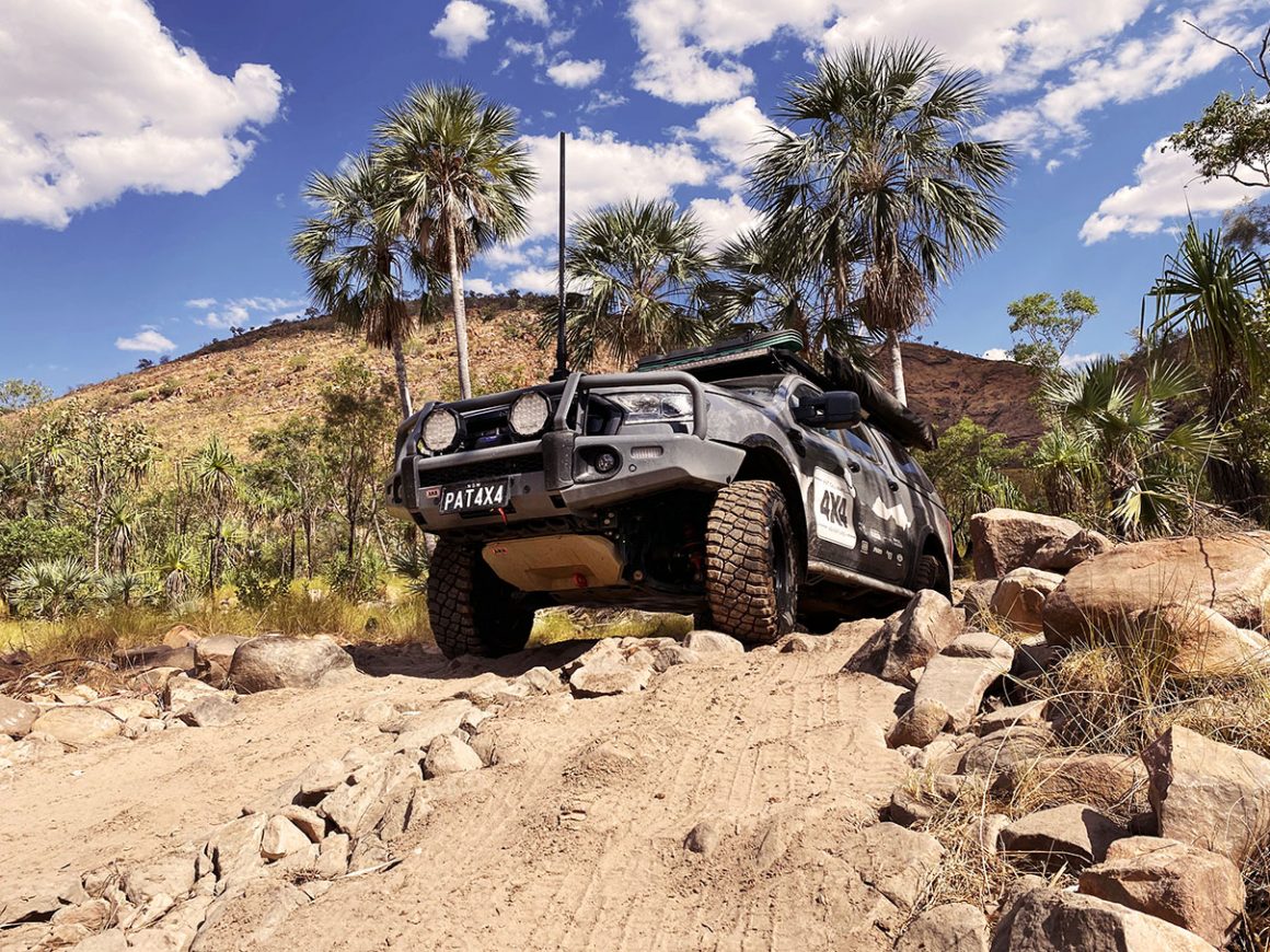
Kimberley locals are rather protective of their secret waterholes, and it took more than one beer to get them to divulge this next spot. You see, whenever we mentioned ‘Secret Springs’, their information would be pending a caveat: “As long as you don’t tell anyone else”. Sorry, I’m in the game of ‘telling everyone else’, so I couldn’t play that game. But one outstanding local gave me the goss, and their anonymity shall remain protected to avoid recriminations!
Around four kilometres west of the Ivanhoe Crossing, there’s an old cattle grid and fence post. The grid is only half showing as it’s covered in dirt. Take the track towards the ranges, and at the Y-Junction go left. Follow the single lane track through the scrub, and when you hit the gate, the waterhole is not too far from there. Upon arrival, you’ll need to push past the first pool, and then you’ll find the second pool. Welcome to Secret Springs. Unlike Secret Springs No.1, No.2 sees very few travellers.
It’s a beautiful secluded waterhole, fringed with figs and palms. There are also butterflies aplenty in this gorgeous valley.
I have to say it felt like an achievement to find this spot. If you find it too, make sure you treat it with the respect it deserves.
ORD RIVER
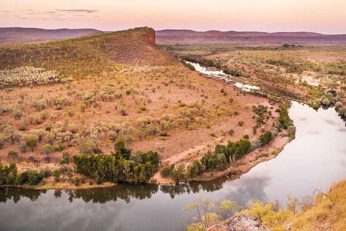
Before the damming of Lake Argyle, the Ord River used to be a series of waterholes that would cease to flow in the dry season. Now, she flows year-round, and the abundance of wildlife this has created is astounding. The birdlife is incredible, as are the barra. And the crocs? Well, they’re dining on five-star fish and beef every day. The latter comes from an unfenced cattle property that adjoins the river. Locals believe between 500 and 700 cattle are taken by crocs each year. As a tourist, it’s hard to understand why the farmer doesn’t pump water up the hill and fence the river off. But there may be other factors at play of which I’m unaware.
I spend the day on the Ord with Mick from Salty Dog Safaris. The team at Salty Dog are long-time Kimberley locals, and their property is a superb place to camp. With river frontage, brilliant views, a tank pool and hot showers, it’s the sort of place our readers will love. Salty Dog offers nature tours or fishing tours, or as we did, a mixture of both. We managed to catch a tasty 58cm barra, but the highlight for me was Mick’s excellent knowledge and commentary. The tour was brilliant, and I can understand why Salty Dog is booked out months in advance.
EL QUESTRO – KIMBERLEY ICON
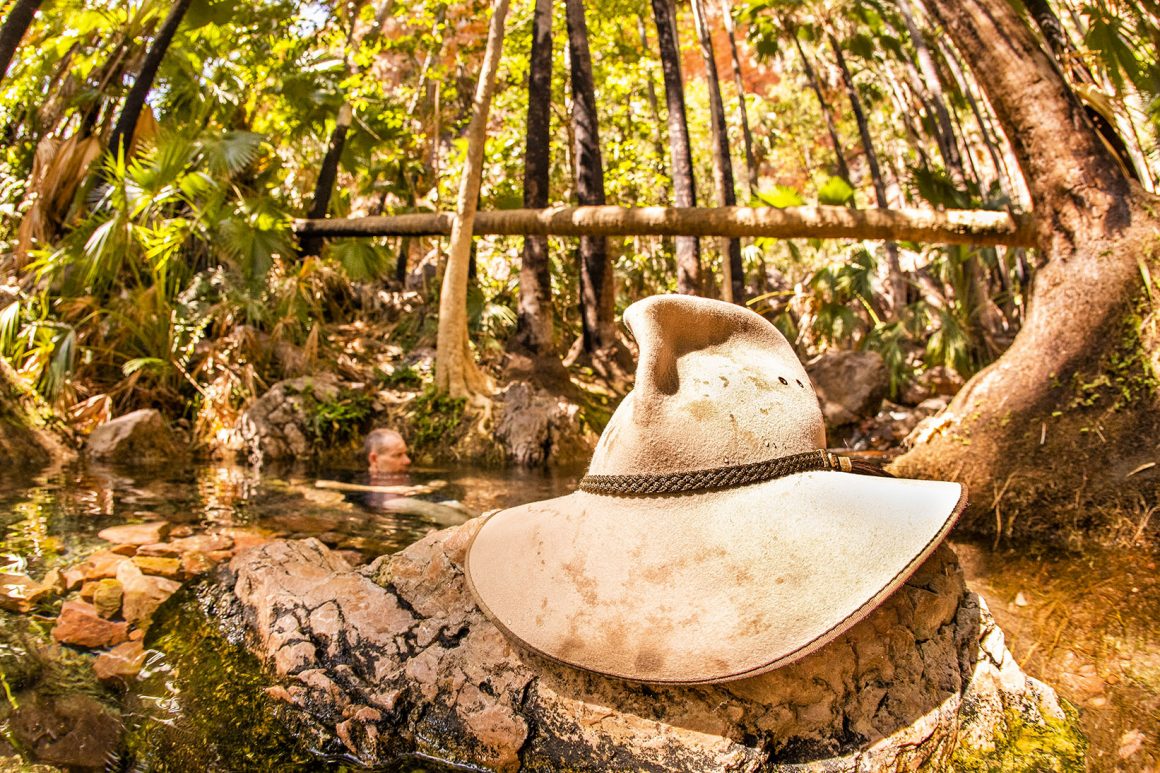
I was fortunate on this leg to be joined by another legendary local, Scotty Connell from Kimberley Spirit. He showed us some of his favourite spots around El Questro Station. For the uninitiated, El Questro is home to some of the finest Kimberley scenery you’ll see. The property is well equipped, and guests can choose everything from unpowered campsites up to the luxury $18,000 per night guest house. Fishing, four-wheel driving, bushwalks and heli-rides are also on offer. El Questro was recently bought by the G’Day Group, which is one of the biggest owners of caravan parks in Australia.
Our first stop was Zebedee Springs. It’s like an immaculately landscaped paradise, with 32-degree clear water flowing over rocks and around the roots of Livistona Palms, which are endemic to El Questro. Rumour has it that Nicole Kidman and Keith Urban conceived one of their babies here after swimming in the magical waters. Access to Zebedee is limited, though, as it’s reserved for the exclusive use of lodge guests at certain hours of the day.
Saddleback Ridge was the next stop, and it’s an essential drive if you love your four-wheel driving. It does require low range, and some of the switchbacks are pretty rough. The El Questro website reckons the track is ‘Difficult’ and suited to experienced four-wheel drivers, but I think it should be classed more on the east side. The main damage you could encounter is relying on your brakes on the way back down and burning them out. There’s a giant viewing platform at the end of the track that affords superb views over El Questro. Allow a few hours to drive Saddleback Ridge, and perhaps reserve it for a sunset drive and a few non-alcoholic Shandy’s at the lookout.
Yet the battle of the sunset lookout is tough at El Questro. While Saddleback Ridge is amazing, Branco’s Lookout is ‘amazing-er’? Branco’s is a solid one hour drive from El Questro HQ, and the drive takes you through some fantastic scenery, past the Durack Tree (a giant gnarly Boab) and across boulder-strewn rivers. But the beauty of the lookout itself is incredible, with great river bends and ranges making photo opportunities galore. And Scotty, who happens to be the reigning WA Tour Guide of the Year, tells me this is his favourite lookout. Say no more.
HARRY’S HOLE
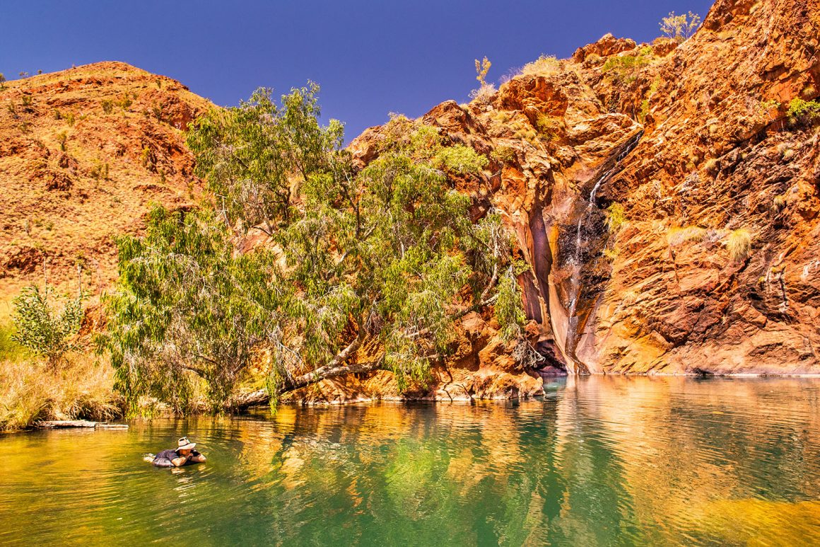
Only in Australia would you name a place of incredible beauty, ‘Harry’s Hole’. Perhaps it’s designed to put people off the scent. And with no signs at the gate and being on private property, it doesn’t strike me as a place that wants too many visitors.
Your first stop is the Doon Doon Roadhouse, which sits 100km south of Kununurra on the Great North Highway. Here, you’ll pay a fee ($35) and a key deposit ($20). But more importantly, they’ll give you instructions on how to access the property- instructions you’ll need if you are to find it. The gate looks like every other stock gate in the Kimberley!
The drive to Harry’s Hole is the epitome of why you buy a 4X4. It’s a single lane track that takes you through spinifex, dry river beds and mind-blowing scenery. It’s a meandering two-hour run, and I can’t emphasise enough the arid beauty. The reds of the ranges, the green of the spinifex – it’s pretty special. As you get closer to Harry’s Hole, you’ll start to encounter water crossings. Dense grasses adorn the track edge, and you feel like you’re forging your own jungle path. Just try wiping the grin off your face here! All of the water crossings are firm and relatively innocuous, except for the last one. When you’re almost there (I’m talking a few hundred metres away), you have two options. Go straight across the creek, or drive up the stream. Both options ‘look’ fine. Take the short way, as driving up the creek you’ll encounter deep, car swallowing holes.
On arrival at Harry’s Hole, you’ll find a sand flat that makes an ideal camp. Shaded by paperbarks, it’s something akin to paradise. But that’s nothing when you see the waterhole. Red rock, constant flowing spring water and framed to perfection with a giant Melaleuca ‘jump tree’ hanging over the deep hole. Explore further, and you’ll find a natural rock cave, and go upstream and you’ll find even more waterholes. To put this place in perspective, if someone said to me they could only do one drive in Western Australia before they die, I’d say: “Get your backside to Harry’s Hole!”