

Advertisements
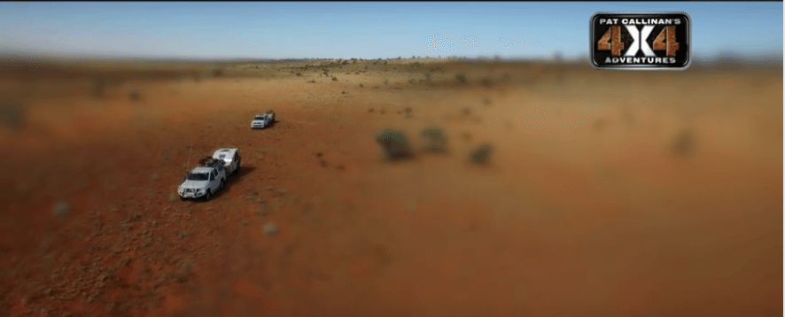
When the clock strikes 2PM this Sunday, ensure you’re not far from the telly. Why, because we’re showing you one of the biggest and most challenging trips we have ever undertaken, through the Simpson Desert. Leaving the French Line behind, Pat and his two boys go off-track to find one of the most remote parts of the Simpson Desert. Heading into the trackless parts of the desert, They aim for the Geographic Centre of the Simpson Desert.
Advertisements
AIRING TIME: This Sunday, 15th November, 2PM.
Advertisements


3 comments
Hi Pat
Just watched the Geographic Centre of the Simpson episode which left me with considerable nostalgia since I know the area very well. If you do keep going along the NS shot line to Geosurvey Hill then you will pass very close to a confluence (a confluence is where whole degrees of both latitude and longitude intersect) which we claimed for a friend Ron McKendry, a great desert adventurer.
I am writing this note to give you the reason they are called “shot lines”. In the sixties when oil exploration in the Simpson peaked, exploration technology was still somewhat primitive. To map the underground structures small explosions were set off and the echos recorded – a sort of ultrasound of the ground. To get the results as clear as possible the “shots” (the small explosions) were placed in a straight line at known points – that is along the “shot line”. So the shot lines were quite precise in their location and direction. Originally all the shot lines were clearly marked with tags on star pickets – but very few are left today – and you determine which shot line it was by looking at the tag. This of course was VERY useful before GPS/SatNavs and enabled us when we came to intersecting shot lines to work out exactly where we were.
I assume from your comments in todays show that you will head for Geosurvey and then cut across to the Colsen Track. If you just keep heading north from Geosurvey you would be following Reg Sprigg’s path across the Simpson (in 1962 over 50 yrs ago). About a days drive (25 kms) north is a very large claypan which Reg called T13, a claypan big enough, and with a surface like concrete, to land a Jumbo on. About 5 km long and 2 km wide in fact. At the southern end is a small cairn of rocks so some years ago now after having been there I rang Reg. He who would have been in his late 80’s at that time. I explained that he did not know me and that I had a rather strange question for him about a cairn of rocks – he was a little cautious.
Then I said “Do you remember a claypan T13 in the Simpson Desert ?”.
His voice change completely and boomed down the line “Of course I do my boy – what would you like to know about it ?”
That broke the ice and we had a great desert chat which concluded with him saying ” I really wish I could have been with you, I greatly miss the desert.”
That I think sums up the feeling that gets into your blood when you become “a desert rat”, as I am.
Rgds Bill
how can I watch this episode
just finished the geo centre and geosurveyors hill we went via the qaa and the french line up the colson track to camp 5 across to camp 8 then south it was very rough going after we left the centre we headed for the old fuel dump then straight up the dunes to camp 9 not recommended for the light hearted we then went to camp 15 and lake caroline to batton hill up the hay river road i recommend Chris s tour at batton hill all in all it was a great trip and i strongly recommend you have a hema hx1 navigation system they are great.