

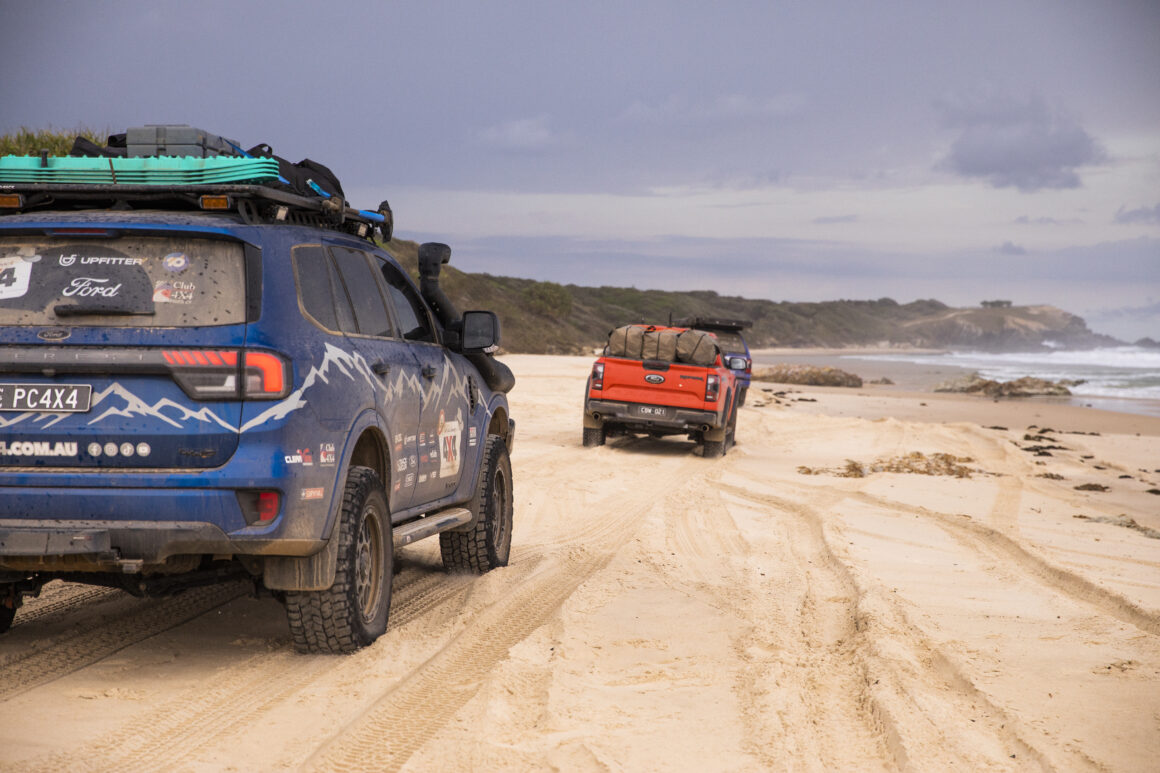
In Western Australia’s Midwest, the tracks are being laid — both literally and politically. The coastal councils of Coorow, Dandaragan and Gingin have come together to draft a master plan for managing beach driving between Guilderton and Leeman, and the clock is ticking for public feedback.
The goal? To protect fragile dune systems from worsening erosion and avoid losing access to iconic beach tracks altogether.
It’s a worthy cause, no doubt, coastal erosion is a real issue, and it’s clear some tracks have been formed in places they probably shouldn’t be. But if you’re a 4X4er who values beach access and freedom to explore, now’s not the time to assume someone else will take care of it. This plan is open for public comment until May 15, and if the community doesn’t speak up, we can’t complain when access disappears behind a locked gate.

The Plan: What’s Being Proposed?
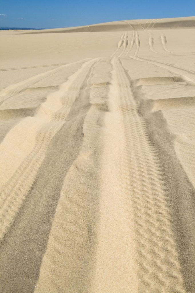
According to Dandaragan Shire President Tony O’Gorman, the issue comes down to drivers veering off established tracks and carving new ones through the dunes particularly around sensitive areas like North Head, home to a WWII radar station.
He reckons what used to be one or two problem areas have now turned into “10 or 20 spots where the sand continually gets eroded away.”
The draft “Coastal Recreational Track Management Master Plan” aims to get things under control before the entire coastline starts shifting. It’s a balancing act: protect the environment without banning the lifestyle entirely. On paper, that’s exactly what we want — if it’s done right, but that’s a big if.
Where the Rubber Meets the Sand
Here’s the kicker. While the plan talks about protecting access in the long term, these things can easily drift toward closures, locked gates, and red tape if we’re not vigilant. That’s not fearmongering, it’s the pattern we’ve seen in plenty of other parts of the country.
As Elizabeth Harding from the WA 4WD Association points out, most 4X4ers do the right thing. Clubs leave no trace, drivers stick to the tracks, and there’s an unwritten rule among seasoned beach-goers to look after the place like it’s your own. The trouble is, a few rogue operators can ruin it for everyone, especially when councils are under pressure to act.
That’s where you come in.
Why You Should Have Your Say
This isn’t about drawing a line in the sand, it’s about being at the table while the line is being drawn. If we want this plan to work for the 4X4 community rather than against it, we need to show up and be counted.
Are there enough designated tracks in the plan? Are the routes practical for actual vehicles, not just maps on a whiteboard? Are there provisions for future access or just restrictions?
Too often, these plans are shaped by consultants and councils who don’t live and breathe the lifestyle. The more 4X4ers who speak up, the better chance we have of seeing a plan that reflects the reality on the ground.
What Now?
The draft plan is open until May 15, and submissions are being taken now. If you’ve ever driven the coastline around Jurien Bay, North Head, or Guilderton — or you plan to one day then this is your chance to help shape its future.
At the end of the day, we all want the same thing: to keep enjoying the coast while making sure it’s still there for our kids and grandkids. That means looking after it and holding land managers accountable for fair, practical, and evidence-based decisions.
So take five minutes. Read the plan. Give your feedback. Because once access is lost, it’s bloody hard to get back.


3 comments
police the plan . identify those not doing the right thing , identify their vehicles and ban them . produce posters of repeat offenders and offer the public a reward for information and images of vehicles infringe them and ban them .
some light reading
A regional shire claims its new proposed local law will not limit beach access for four-wheel-drives despite the new rules laying the foundation for changes in the future.
The Shire of Waroona released a proposal for its Local Government Property and Public Places Local Law 2025 last week for review, outlining several changes in the area including vehicle access to the coastline.
The document states a person shall not, without the permission of the local government, drive or ride any vehicle on the beach or sand dunes, or risk a $500 fine.
The proposed changes come more than a year after the shire voted to investigate implementing a permit system to the beach access at Preston Beach in order to reduce the impact visitors are having.
Waroona Shire’s chief executive Mark Goodlet said the intention of the new local law was not to limit access for 4WDs on the beach in any capacity, instead giving the shire more control in exceptional circumstances.
“The local law gives the shire the ability to control access and there will be the odd instance when the shire needs to prevent use of the beach, such as the whale carcass removal activity last year,” he said.
If the gates are open there is permission to use the beach.
Shire of Waroona CEO Mark Goodlet
“If the gates are closed, permission is not granted and we don’t want people driving around the gates or worse, through the dunes to get to the beach.
“This is not a blanket ban on 4x4s on the beach, which we know the community and visitors love to do.”
However, Mr Goodlet said the proposed local law would be compatible with a permit system if the shire does decide to implement the policy in the future.
“The way the local law is worded it would be compatible with a permit system if it ever eventuated,” he said.
“But the primary intent is to regulate closure of the beach if it is ever needed.”
Permit system, in theory is ok, but another way to make people pay, revenue raising.
I don’t for one minute think it will be free, if there is going to be a fee then make it free for 4×4 registered club associations members, they have their own club insurance and most will have comprehensive insurance.
My club requires comprehensive cover as a condition of membership.
Most clubs have a rule, leave nothing but footprints when you leave camp.
This will encourage people to join 4×4 clubs and be bound by the national 4×4 association rules.