
In an age dominated by digital navigation, the art of reading a paper map may seem like a relic of the past. Yet, for 4X4ers mastering this skill is not just about tradition but also about safety, independence, and the thrill of exploration. Topographic maps, or topo maps, offer a wealth of information, depicting the beauty and challenges of the terrain ahead in a way no GPS can. Topographic maps are distinct from ordinary maps. They don’t just show roads and trails; they enable you to visualize three-dimensional terrain on a flat piece of paper. This is accomplished through contour lines, scale, and a legend that deciphers symbols and colours.
Map reading is an essential skill for safety and emergency planning. By understanding the terrain and features of your chosen area, you can identify potential hazards, such as steep cliffs, river crossings, or dense forests. This knowledge allows you to plan safer routes, avoid risks, and prepare for emergencies. Moreover, in situations where technology fails or GPS signals are lost, a paper map becomes an invaluable tool for finding your way back to safety. This guide aims to give you an intro to paper maps. How to read them, how to use them to work out where you are, and how to use them to plan a route understanding what the terrain you’re heading to will actually look like.
WHAT IS THE MAP TELLING YOU?
Contour lines are the heart of a topographic map, connecting points of equal elevation. By examining these lines, you can understand the terrain’s shape and steepness. When contour lines are close together, expect steep slopes; when they’re spread apart, the land is more gentle. Small concentric circles indicate peaks, while lines forming a V-shape with the point upstream signify valleys or ravines. Every fifth contour line is an index line, thicker and usually marked with elevation numbers. The difference in elevation between lines, known as the contour interval, is crucial for gauging the terrain’s vertical challenge.
To truly master topographic maps, one must learn to interpret contour lines not just at a basic level but with a nuanced understanding of the terrain they represent. For instance, closely spaced contour lines indicate a steep gradient, ideal for those seeking challenging trails. Conversely, widely spaced lines suggest a flatter area, suitable for beginners or when you prefer a smoother ride. Recognizing patterns can transform how you plan your route, allowing for a tailored off-road experience that matches your skill level and adventure goals.
Beyond identifying the steepness of slopes, contour lines allow for elevation profiling—a technique to visualize a cross-sectional view of the terrain. This can be particularly useful in planning how to approach a steep ascent or descent, preparing for elevation changes that will impact fuel consumption, and assessing the difficulty of the terrain for your vehicle. By drawing a line across the route on the map and marking the elevation at regular intervals, you create a profile that gives you a side-view snapshot of the upcoming terrain’s ups and downs.
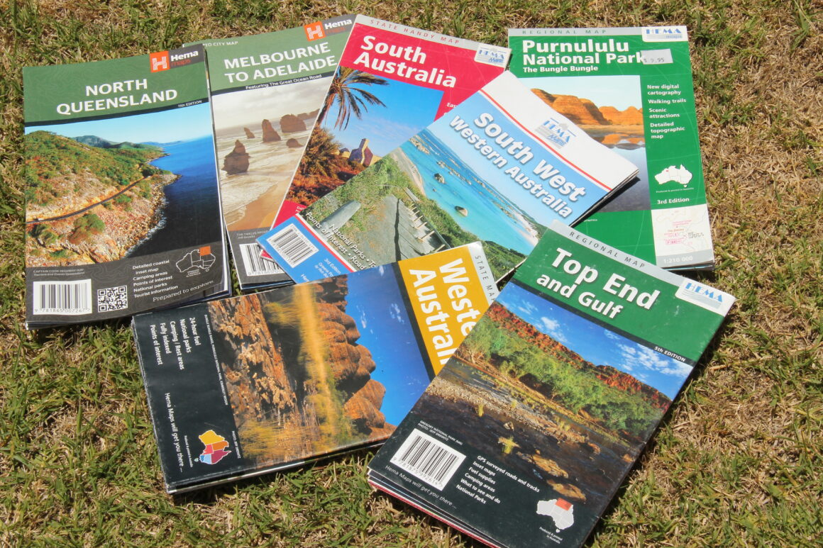
You’ll also need to factor in the scale of the map too. It will tell you not just about the size of the area it covers, but how much detail you’re actually getting. A scale of 1:1,500,000 means one centimetre on the map equals 1,500,000 centimetres in the real world, or 15km. You could expect a map like this to cover a whole state. You’ll see towns and major roads, but not tracks and campsites. In contrast, a map with a scale of 1:130,000 each centimetre on the page will cover just 1.3km allowing you to see the nitty-gritty details of where you are and is ideal for planning specific routes or understanding the terrain. Using the map’s scale, alongside a compass or a string, can help you calculate distances accurately, a vital skill in remote travel where every kay counts.
READ THE MANUAL
The legend is your map’s user guide, explaining the meaning behind various symbols, lines, and colours. Generally, darker colours indicate denser vegetation, while lighter colours show open terrain or higher elevations. Blue is universally used for water features. The legend also includes crucial information like the contour interval, magnetic declination (important for compass use), and the map’s revision date, ensuring you’re working with the latest information.
Topographic maps are rich with symbols representing natural features such as rivers, lakes, forests, and rocky areas. Understanding these symbols can significantly enhance your navigation skills. For example, water bodies are crucial landmarks for orientation but also represent potential obstacles or points for water crossings. Vegetation areas indicated by darker shades or specific tree symbols can suggest the presence of trails that might not be visible on the ground. Learning to read these signs enables you to navigate more effectively, making informed decisions about your route based on the terrain and natural features.
CAN YOU TRUST YOUR COMPASS?
Navigating with a map and compass requires a solid understanding of magnetic declination—the difference between magnetic north (where your compass points) and true north (the direction towards the geographic North Pole). This discrepancy arises because the Earth’s magnetic field lines are curvy, not straight, leading to varying declination values across different locations. True north is a fixed point that maps are oriented to, while grid north refers to the northward direction along the map’s grid lines, which can slightly differ from true north depending on the map’s projection. Magnetic north, on the other hand, is the direction a compass needle points, influenced by the Earth’s magnetic fields, which shift over time.
To navigate accurately in the wilderness, it’s crucial to adjust your compass to account for the local magnetic declination—a value that changes with location and over time. The map you’re using should give you the correction factor for your location. This adjustment ensures that your navigation aligns with the map’s orientation, preventing potential errors that could lead you off course. Understanding and applying this concept is essential for safe and successful navigation during your off-road explorations, allowing you to confidently traverse the landscape with precision.

BACK BEARINGS – HOW TO WORK OUT WHERE YOU’RE GOING
Using back bearings from three known landmarks is a classic and effective method to calculate your position, a technique often referred to as triangulation in navigation. This method involves identifying three distinct landmarks that are visible both on your map and in the terrain around you, such as a mountain peak, a tower, or a lake. Using your compass, you take a bearing from each landmark to your current position. For example, if the compass is orientated north, and the landmark you’re looking at is on an angle of 270 degrees away from you, minus 180 (you’re heading back remember) and any magnetic declination corrections then draw a line on whatever angle you come up with. You should be somewhere along the line. Do it two more times from other landmarks, and where those lines intersect should be where you’re standing.
This triangulation method is invaluable when you’re unsure of your exact position, providing a clear and precise way to pinpoint your location on the map. It’s crucial, however, to ensure accuracy in taking bearings and to use landmarks that are well-defined and spaced apart on the map to avoid large errors in your calculated position, you may need to get to a lookout or clearing in order to actually spot landmarks you can use. Mastering the use of back bearings for triangulation enhances your navigation skills, offering a reliable way to orient yourself in the wilderness and maintain your course during your 4X4 adventures.
HOW TO PUT IT INTO ACTION
Understanding how to read a map is just the beginning. Applying this knowledge on the trail requires practice and patience. Before setting off, spend time studying the map of your intended area. Visualize your route, noting challenging terrains like steep slopes or dense forests, and plan accordingly. Remember, off-road travel can be unpredictable; a seemingly straightforward trail on the map can present unforeseen challenges in reality.
In addition to natural landmarks, topographic maps also detail human-made structures, such as roads, trails, buildings, and bridges. These elements are crucial for 4X4 navigators, providing insights into the accessibility of an area. Roads and trails on the map can help you plan your access points and exits, while symbols for campgrounds, picnic areas, and other facilities can assist in logistics and safety planning. Understanding the symbology for these features allows for a more comprehensive preparation, ensuring that your adventure is both enjoyable and safe.
PRACTICE MAKES PERFECT
Mastering map reading is an art that enhances your connection with the outdoors. It encourages a deeper appreciation of the landscape, fosters a sense of self-reliance, and enriches your off-roading experience. Here are additional tips to further develop your navigation skills:
Practice Regularly: Familiarise yourself with maps of different scales and terrains. Practice plotting routes and reading the landscape through the map.
Join Workshops or Courses: Consider participating in navigation workshops or courses. These can provide hands-on experience and insights from experienced navigators.
Learn from Experience: Each trip is a learning opportunity. Reflect on your navigation choices, what worked well, and what could be improved. Sharing experiences with fellow travellers can also offer valuable lessons.
Familiarize Before You Go: Study the map extensively and compare it with other sources or local knowledge. Look for landmarks that can serve as navigation points.
Keep It Accessible: While on the trail, keep your map in an easily accessible spot. A waterproof map case can protect it from the elements.
Practice Compass Skills: Learning to use a compass in conjunction with your map is invaluable, especially in areas where GPS signals are unreliable.
Pair With Technology: Use your map alongside GPS technology for a comprehensive navigation strategy. The map offers the big picture, while GPS can provide real-time positioning.
PARTING THOUGHTS
Reading a paper map is a fundamental skill for any 4×4 enthusiast. It not only prepares you for the challenges and joys of off-road travel but also connects you more deeply with the natural world. As you grow more proficient in interpreting contour lines, understanding symbols, and integrating the map’s information into your travel plans, you’ll find that each journey becomes more rewarding. The ability to navigate confidently through unfamiliar terrain, relying on your skills and a trusty map, is not just empowering—it’s a testament to the spirit of adventure that drives all 4×4 travelers. So, as you prepare for your next expedition, remember that the map in your hands is not just a tool, but a gateway to discovery, inviting you to explore the vast and varied landscapes that await beyond the beaten path.