

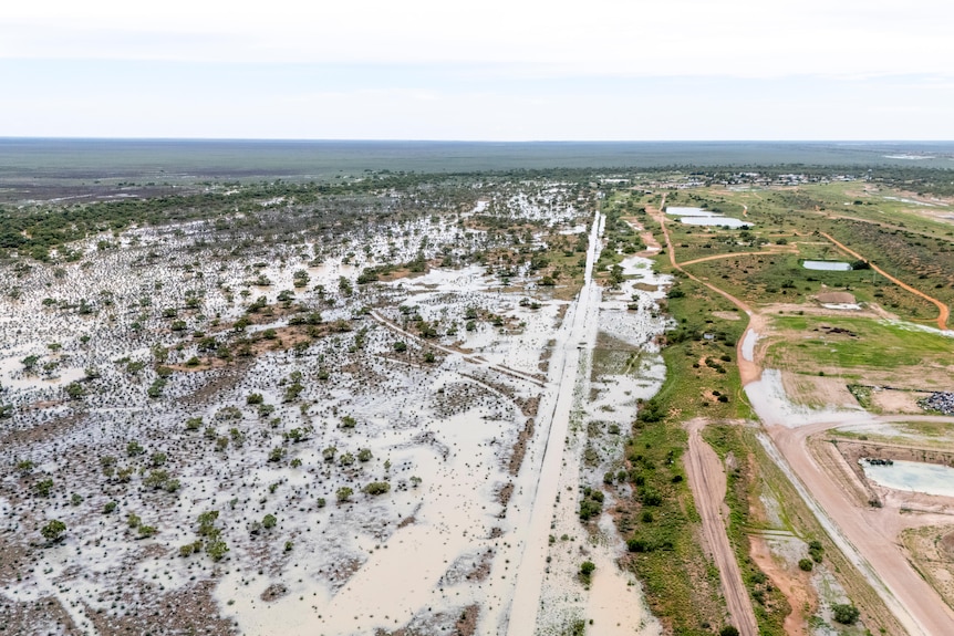
We’ve just seen some fresh updates coming across the desk from the Birdsville Hotel and the Diamantina Shire Council, and it’s a bit of a game changer for anyone sitting in a caravan park in Queensland wondering if they can finally make the dash. While previously the Birdsville Track in South Australia looked like a permanent water feature, the northern and eastern approaches to the iconic pub are officially back in business.
The Birdsville Hotel is calling it: the roads are open. If you’re coming from the east or the north, the beer is cold and the path is clear, provided you’re sitting in something with decent ground clearance. It’s a massive win for the region, which has been doing it tough with the recent deluges.
Eastern and Northern access restored
From the east, the run from Windorah to Birdsville is now open to high clearance vehicles. We’ve also heard that the leg between Quilpie and Windorah has been clear for a few days now. This effectively opens up the main vein for anyone trekking out from the coast. The legends at the Birdsville Roadhouse and Merv’s in Windorah have also had the tankers through, so diesel and ULP supplies are topped up and ready for the influx.
Coming from the north, the Boulia to Birdsville run via Coorabulka Road is also open. There is a slight detour in place using the Lake Machattie bypass, and the council is urging extreme caution due to some lingering road damage. The Diamantina Development Road from Bedourie to Boulia is also open with caution, though the leg from Bedourie to Windorah remains shut due to flooding at Farrars Creek and Monkira.
The border crossing and Big Red
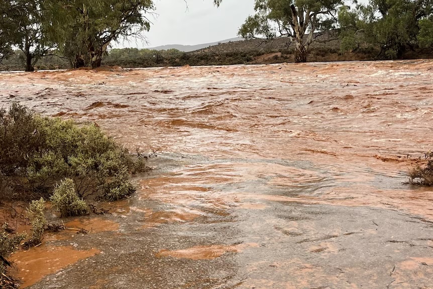
For those of us looking to poke the nose into the desert, the Eyre Development Road from Birdsville down toward the SA border is now showing as open with caution for high clearance rigs. There’s still water over the road in places, so don’t go charging in like a bull at a gate. Big Red is also accessible, though you’ll likely be dealing with water over the track, which usually makes for some pretty epic photos but a bit of a messy recovery if you get it wrong.
It’s important to note that while the Queensland side is drying out and opening up, the South Australian side of the Birdsville Track, from the border down to Marree, remains a different story. The SA authorities are still listing the track as closed due to the Cooper Creek flow. You can get to Birdsville from the north and east, but don’t expect to punch straight through to the Flinders just yet.
Fuel tracking and planning ahead
One of the best bits of kit to come out of this update is a new Fuel Tracker website specifically for South-West Queensland. It’s designed to give real-time info on who has what in the tanks, which is gold when you’re balancing your weights and distances between remote stops. You can find that at the Fuel Tracker website for the South West Queensland Regional Organisation of Councils.
We’re seeing a lot of movement now that the sun has been out. The graders are flat out and the shire councils are doing their best to get the gates open. If you’re heading into Birdsville, just remember that “open” in the outback often means “open if you know what you’re doing.” Keep an eye on the Diamantina Shire reports and have a cold one for us when you finally park the rig in front of the pub.


1 comment
How bad are the mozzie populatons out there now Pat? Have they gone berserk yet?